We operate in 2 regions
Los Ríos and Los Lagos
We provide drone-based crop protection, fertilization, multispectral analysis, photogrammetry and other precision agriculture services.
Request a QuoteLos Ríos and Los Lagos
Precision agriculture
Fertilizers, crop protection products, and broadcast seeding
Aerial photographs (orthomosaics) and multispectral analysis
If an application is not what your farm needs, we will tell you. We prefer an honest conversation over an easy sale.
We measure our work by the outcome, not by the hours. If doing the job well means starting before dawn or flying at night, that is what we do.
Before taking action, we study the crop, the terrain and the problem. We apply the same care to spraying, mapping and advisory work.
We measure our work by the results you achieve, not by the hectares we fly over.
Ultra-low-volume applications that save water, variable rates that reduce agrochemical use, and techniques that protect soil structure.
We invest in equipment and R&D to keep developing and offering innovative services that bring real value to our customers.
We actively foster a supportive environment and respectful treatment within our team, with our customers and suppliers, and throughout the communities where we work.
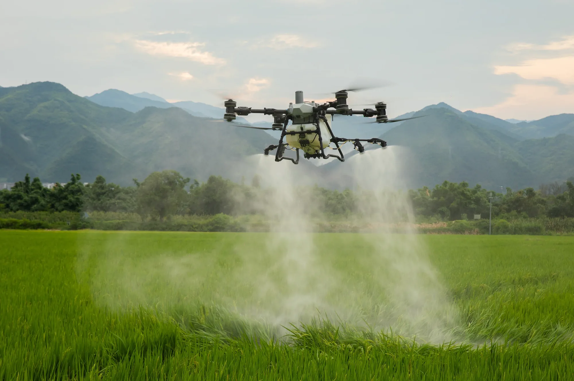
Manage crop protection efficiently with drone-based liquid applications ranging from 20 L/ha to 100 L/ha.
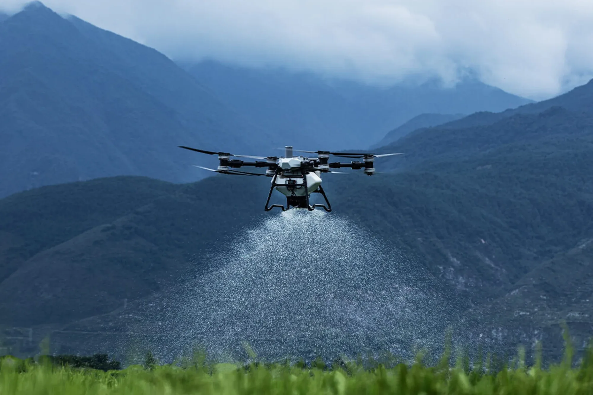
We apply fertilizers and biostimulants in both granular and liquid formats, with granular application rates ranging from 3 kg/ha to 200 kg/ha.
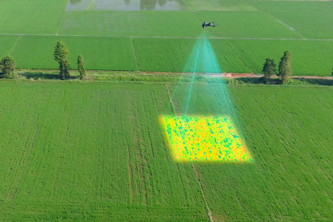
We generate aerial imagery, orthomosaics and multispectral maps to support better-informed decisions and develop variable-rate application strategies.
The right choice depends on terrain, weather conditions, crop type and the specific operation required.
An agricultural drone is a larger aircraft with greater payload capacity, designed to spray liquids or spread solid products over crops using high-precision GPS navigation. Unlike a photography or recreational drone, it is built for work: it carries tanks, nozzles and dosing systems, and its flights are planned according to the terrain and the type of application.
On virtually any crop: pasture, potatoes, corn, rapeseed, small fruit crops (such as berries), larger fruit crops (such as European hazelnuts and cherries), and forest plantations, among others. It is especially efficient in orchards, where it does not have to travel between rows as a tractor does, avoiding the associated harvest-time logistics of clearing access for ground machinery.
They do not compete; they complement each other. A drone is the best option on slopes or hard-to-reach terrain, very soft pasture (for example, in winter), small-scale uniform applications, small fruit crops requiring moderate spray coverage, and tall forest plantations. A tractor remains efficient across large, flat, easily accessible areas with firm ground. The right choice depends on terrain, weather conditions, crop type and the specific operation required.
We apply both liquids and solids. Liquids include pesticides, biostimulants and foliar fertilizers, at rates of 20 to 100 liters per hectare. Solids (granules) include fertilizers, molluscicides and seed for reseeding (for example, clover), at rates of 4 to 200 kilograms per hectare, depending on the product and objective.
Yes, provided the flight is properly calibrated for the product, dose and crop. Today’s agricultural drones spray with adjustable droplet sizes and flow rates that provide even coverage, while low-altitude flights reduce product drift compared with other aerial application methods.
It means applying different doses within the same field according to the actual needs of each area, rather than a uniform dose across the entire field. We identify those zones using the farm’s own multispectral maps. When properly carried out, this approach can save up to 10% on fertilizers and up to 60% on pesticides without sacrificing application effectiveness.
Yes. This is one application where drones make a particularly big difference: broadcast seeding rotational crops. A typical example is sowing oats or ryegrass over a corn field one month before harvest, allowing germination to begin earlier during the fallow period and adding dry matter to the farm.
It is a high-resolution aerial image of the entire property, assembled digitally from many individual photographs taken by the drone. It is used to measure areas accurately, plan access routes, identify drainage or erosion problems, and provide a visual basis for management decisions.
A multispectral camera captures information the human eye cannot see, such as near-infrared light, as well as visible light. This data is used to calculate vegetation indices such as NDVI, revealing plant vigor and health across the field. It can help identify water, nutrient or disease-related stress before it becomes visible to the naked eye.
It depends on the objective. For a specific decision, such as planning variable-rate fertilization, one flight at a key stage of the crop may be enough. To monitor a field throughout the season, we recommend periodic flights at the most relevant stages: emergence, vegetative growth and before harvest, adjusting the frequency to the crop.
Yes, it is a regulated activity. The company and its pilots must have authorization from Chile’s Directorate General of Civil Aviation (DGAC) to operate the drone, as well as accreditation from the Agricultural and Livestock Service (SAG) to apply pesticides. At Glaube, we hold both certifications.
In addition to the pilot’s own credentials (a DGAC pilot license and SAG applicator credential), a company that applies pesticides by drone must have the relevant Health Resolution issued by the Regional Health Secretariat (Seremi de Salud), as well as AOC certification issued by the DGAC. These certifications ensure compliance with Chilean aviation safety and crop protection handling standards.
In several respects, it is safer than traditional methods: it reduces operators’ direct exposure to products because they do not have to walk through crops applying them manually, and its precision reduces waste and drift into non-target areas.
Mainly the area to be treated (because of economies of scale), the type of application (liquid or solid), and the application volume (because it affects drone productivity). Each service is quoted according to the actual conditions of the property, always aiming for excellence and long-term customer relationships.
A clear area for drone takeoff and landing, vehicle access to the property, a nearby water source if needed (only when the full application requires more than 1,000 liters, since otherwise we provide the water), clearly defined boundaries for the field to be treated, and the products to be applied available on site.